Supported Payloads
What Rail-Inspector Requires for processing
Proven Payloads
In order to extract meaningful data from aerial imagery, there exist certain requirements for the data collection platform and the methodology by which the platform captures the imagery. The platforms and payloads described below have been proven to deliver the imagery and metadata in the form and specifications necessary for processing by Ardenna’s AI-based algorithms. The platforms are not the only platforms that can be used and we welcome the opportunity to build-out a larger library of suitable vehicles.
Latitude HQ-60
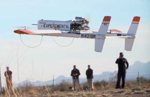
- Latitude Engineering airframe
- Trillium gimbal
- 29 MP Allied Vision camera
- 200mm focal length lens
- 400 ft flight nominal altitude
- 50-60 mph ground speed
- 3 mm GSD
- 10-15% image overlap
ARDENNA M600
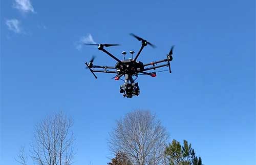
- M600 Pro airframe
- Gremsy T7 gimbal
- 100 MP PhaseOne camera
- 80mm focal length lens
- Ouster OS1 LiDAR
- GeoSnap PPK
- 100 ft flight nominal altitude
- 22 mph ground speed
- 1.5 mm GSD
- 10-15% image overlap
- Rail-Inspector iOS flight app
DJI Mavic2 Zoom
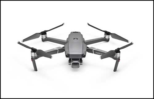
- DJI Mavic 2 Zoom airframe
- DJI Mavic 2 gimbal
- 12 MP camera
- 48mm focal length lens
- 30 ft flight nominal altitude
- 10 mph ground speed
- 3 mm GSD
- 10-15% image overlap
System Requirements
We work closely with our customers and flight service providers to ensure the proper match between the detections required and the platform components and data collection methodology. Rail owners interested in highly accurate gage measurements will require a LiDAR unit to capture accurate altitude. Rail owners interested in joint bar assessment will require an offset image capture methodology in addition to the NADIR capture methodology.
Minimum
- 12+ MP resolution
- 3.0 mm GSD
- 10-15% image overlap
- Automated flight profile
- NADIR camera angle
- RAW image format
desired
- 30+ MP camera
- 1.5 mm GSD
- 10-15% image overlap
- Automated flight profile
- NADIR & Oblique camera angles
- RAW image format
- LiDAR for altitude capture
- PPK for geolocation accuracy
- Rail-Inspector iOS flight app
- GIS track data
Talk with us
We'll leverage our experience in aerial data collection to recommend the most cost-effective platform to meets your needs.
Contact Us